

El Niño is making the Pacific Ocean bluer: See the NASA satellite images
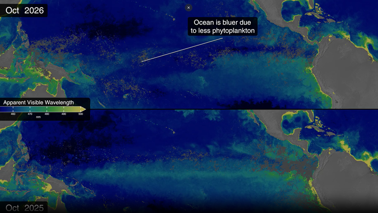
When a historically powerful El Niño scrambles the globe's weather, we expect rising tides, shifting winds, and intense rainstorms. But this fall, NASA satellites are capturing a much more surprising transformation.
The waters of the Pacific Ocean near the equator are changing color, becoming noticeably bluer over the last few months.
Where did the green go?
What we know:
To understand why the ocean is changing color, you have to look at the tiny plants that live in it. These microscopic plants are called phytoplankton. They come in shades of green, brown, and teal, and they are the main food source for ocean life.
Usually, the ocean near the equator is full of these green plants because they love cool water that is packed with nutrients. But right now, the ocean water is getting too warm. Because the water is warm, the deep, healthy nutrients can't rise to the top. Without food, the green phytoplankton are dying off, leaving behind a deep blue, empty ocean.
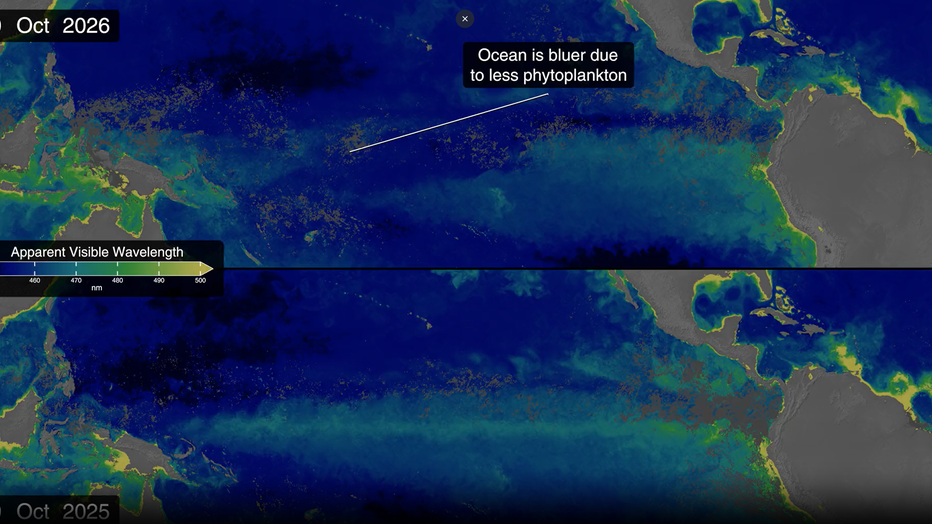
NASA is watching this happen in real-time from space. Their new PACE satellite, launched in 2024, can see hundreds of different colors in the ocean. It shows clearly that the green areas are shrinking as the blue takes over.
What is El Niño?
Dig deeper:
So, what is making the ocean so warm? The answer is El Niño.
El Niño is a natural climate event that happens every two to seven years. Right now, there is an 83% chance that we are experiencing the strongest El Niño since 1950. NASA scientists are closely tracking the phenomenon from its epicenter in the equatorial Pacific Ocean as it drives several massive changes:
- It flips trade winds that typically blow from the Americas toward Asia.
- It redistributes ocean heat and scrambles rain patterns.
- It raises sea surface height across parts of the Pacific.
As these changes take place, people around the world are already experiencing the impacts.

Winter 2023-24 outlook: Strong El Nino boosts odds of warmer temps in North, wet weather in South, NOAA says
El Niño is in place heading into winter for the first time in four years,
Rising heat and higher tides
Why you should care:
The surface of the water is now about 3 degrees Fahrenheit warmer than normal. This giant band of heat throws extra moisture into the air, which changes rain and weather patterns all over the world.
Sea levels near California and South America have also risen by more than a foot. At the same time, water levels near Australia dropped by six to eight inches.
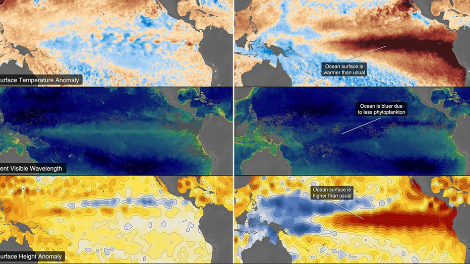
By tracking the heat, the rising water, and the changing colors, scientists can help farmers, firefighters, and coastal towns prepare for what comes next.
The Source: Information from this article was sourced from NASA's El Niño satellite observations posted this month.