

Coastal flooding threat looms for New Jersey, Delaware as nor'easter develops offshore
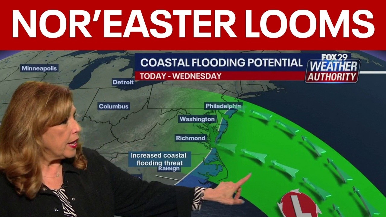
Developing nor'easter to bring coastal flooding risk Monday
A developing nor'easter off the Carolina coast is expected to stay offshore but will still bring high winds, heavy surf, and possible coastal flooding along the Jersey Shore and Delaware beaches this week.
PHILADELPHIA - A developing nor'easter off the North Carolina coast is set to bring coastal impacts including high winds, heavy surf and the possibility of beach erosion.
While the storm is not expected to make direct landfall, areas from the Jersey Shore through the Delaware beaches and down to the Carolinas could feel the effects.
Developing nor'easter and coastal weather impacts
Big picture view:
The nor'easter, currently off the North Carolina coast, is circulating counterclockwise, pushing air and water toward the shore, which raises concerns about coastal flooding and beach erosion.
High winds, heavy surf and possible beach erosion are expected along the coast, with impacts likely in areas as far north as the Jersey Shore and as far south as the Carolinas. Despite these conditions, the storm is projected to remain offshore, but wind and tidal flooding could still affect the shorelines.
Daytime temperatures are forecast to stay close to 66 degrees, with continued sunny weather for inland locations and some lingering clouds along the shore on Tuesday and Wednesday.
By the end of the week, a stretch of clear and pleasant autumn weather is anticipated, which could continue through Sunday.
Timeline:
By midnight and early Tuesday morning, the outer bands of the nor'easter are expected to move closer to the New Jersey and Delaware coasts before dissipating and moving back offshore.
Wind and tidal flooding are still possible even with the storm expected to stay offshore.
A coastal flood advisory has been issued for parts of the area for Tuesday evening's high tide, where forecasters expect minor, but widespread tidal flooding.
Additional rounds of coastal flooding are expected through at least Wednesday night. Wednesday evening's high tide is current of most concern, according to the National Weather Service.
Frost advisories issued as overnight temps plummet
Frost advisories were in effect for parts of the area through 9 a.m. Monday morning. Frost will continue to be a threat to plants and flowers this week with overnight temperatures forecasted to drop into the mid-40s this week, and even the 30s by the weekend.
The Source: This story contains information from the National Weather Service and FOX 29 Weather Authority team.