

Weather Authority: Holiday weekend marked by dangerous wind chills, frigid temps
PHILADELPHIA - The FOX 29 Weather Authority team is continuing to track the big winter storm that has created a travel nightmare for millions ahead of the Christmas holiday weekend.
Here in the Delaware Valley, rain switched over to snow around lunchtime, giving parts of our region a dusting of snow while other areas saw snowflakes that didn't stick to the ground.
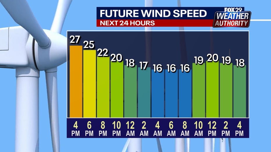
Cold weather is now the most significant weather concern for the region, since the precipitation has moved offshore.
>> For the latest forecasts and conditions as this storm moves through, download the FOX 29 Weather app.
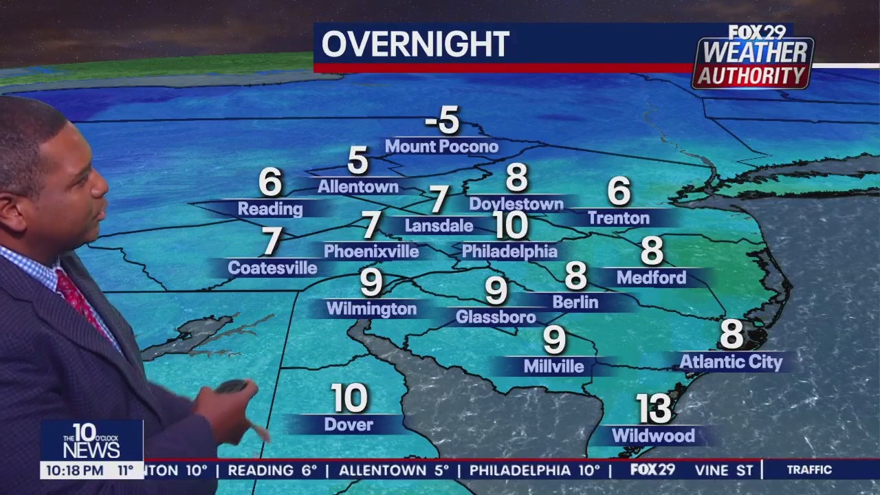
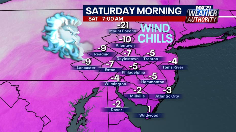
Conditions will remain windy all night as temperatures dip into the single digits and wind chills drop below zero. A Wind Chill Advisory is also in place until Saturday at 10 a.m. for the Delaware Valley. Frost bite can occur within 30 minutes when bare skin is exposed to the elements.
The Delaware Valley is not alone with the wind chills as a large portion of the country also battles dangerous wind chills from an arctic blast.
Saturday will be the coldest weather the area has seen in three years.
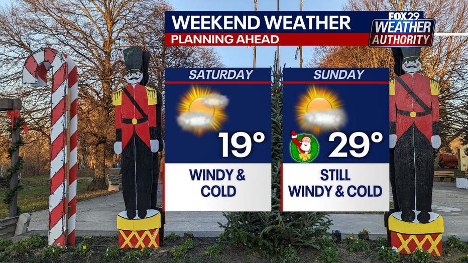
Most areas in the Delaware Valley will only see highs in the teens on Saturday.
On Sunday, highs will be in the 20s, but conditions will still be windy with the return of the sun.
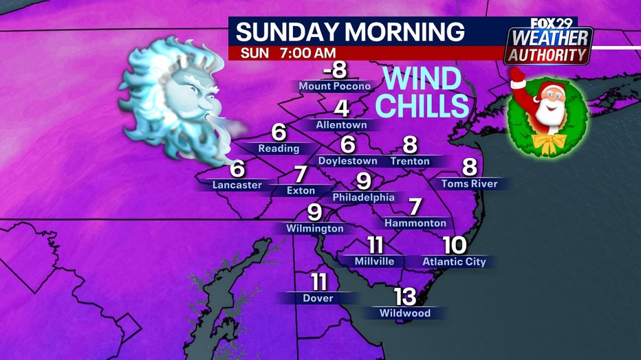
For those with plans to be out visiting family and friends or to attend church services Saturday evening or Sunday morning, make sure to dress warmly, as temperatures will be in the teens with windy conditions.
_______
SEVEN-DAY FORECAST
FRIDAY NIGHT: Partly cloudy, windy. Low: 9
SATURDAY: Windy, cold. High: 19, Low: 15
SUNDAY: Christmas. High: 29, Low: 17
MONDAY: Kwanzaa. High: 31, Low: 23
TUESDAY: Morning clouds. High: 37, Low: 21
WEDNESDAY: Sunny skies. High: 41, Low: 27
THURSDAY: Partly sunny. High: 47, Low: 31