

4 tornadoes confirmed in New Jersey after Tuesday storms; no injuries reported
4 tornadoes confirmed in New Jersey after Tuesday storms; no injuries reported (Photos: NWS)
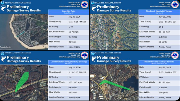
NEW JERSEY - Four tornadoes touched down across New Jersey during Tuesday afternoon’s severe storms, including three EF-1 tornadoes in North Jersey and an EF-0 near the Jersey Shore, according to preliminary National Weather Service surveys.
What we know:
The tornadoes were confirmed in parts of Morris, Sussex and Cape May counties following storms that moved through the region on July 21.
The strongest tornado struck the Lower Berkshire Valley section of Roxbury Township, where estimated peak winds reached 100 to 110 mph.
No injuries or deaths were reported in connection with any of the four tornadoes.
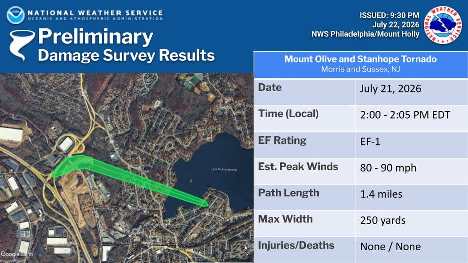
Mount Olive and Stanhope tornado
An EF-1 tornado touched down near Stanhope around 2 p.m. and remained on the ground for approximately five minutes.
The tornado had estimated peak winds of 80 to 90 mph, a path length of 1.4 miles and a maximum width of 250 yards.
The National Weather Service documented extensive tree damage near the interchange of Interstate 80 and Route 206. The damage path continued through Stanhope and toward the southern shore of Lake Musconetcong.
Trees were damaged near homes along Koclas Drive. Shingles were torn from one home, while another sustained gutter damage.
4 tornadoes confirmed in New Jersey after Tuesday storms; no injuries reported (Photos: NWS)
Lower Berkshire Valley tornado
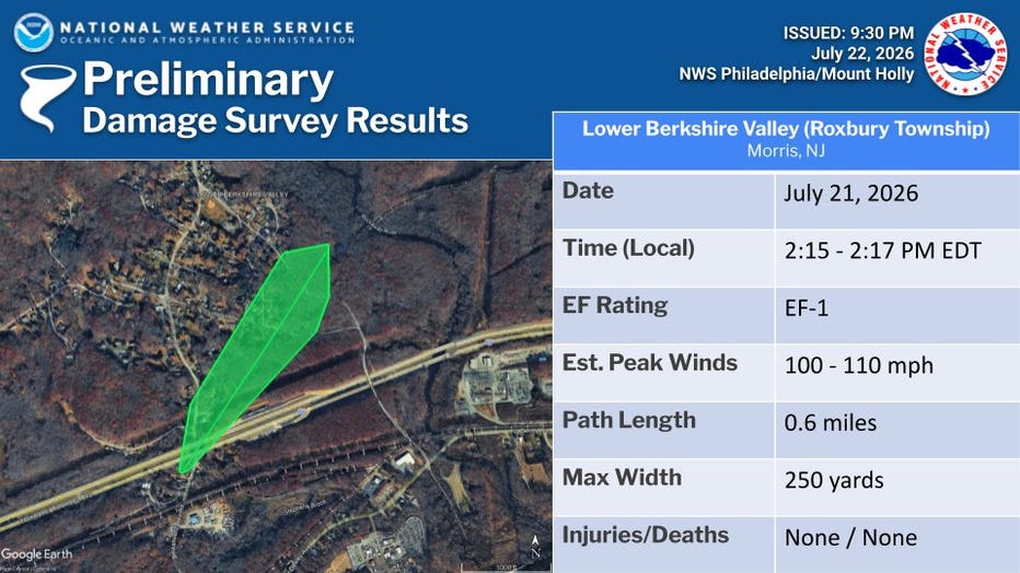
A second EF-1 tornado touched down in the Lower Berkshire Valley section of Roxbury Township around 2:15 p.m.
It remained on the ground for about two minutes, traveling 0.6 miles with a maximum width of 250 yards.
Estimated peak winds reached 100 to 110 mph, making it the strongest of the four confirmed tornadoes.
Several trees were uprooted or snapped along Berkshire Valley Road, Little Lane and Mill Road. Trees and wires were also damaged before the tornado dissipated.
4 tornadoes confirmed in New Jersey after Tuesday storms; no injuries reported (Photos: NWS)
Pine Brook tornado
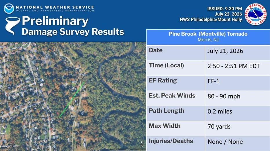
An EF-1 tornado touched down in the Pine Brook section of Montville around 2:50 p.m.
The tornado had estimated peak winds of 80 to 90 mph and traveled approximately 0.2 miles. Its maximum width was 70 yards.
The damage path included uprooted trees, large broken branches and a power pole that snapped at its base and fell across Hook Mountain Road.
Some shingles were also removed from a home before the tornado dissipated near the Passaic River.
4 tornadoes confirmed in New Jersey after Tuesday storms; no injuries reported (Photos: NWS)
Cape May Point tornado
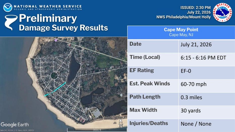
A waterspout moved ashore at Cape May Point around 6:15 p.m. and became an EF-0 tornado.
The tornado had estimated peak winds of 60 to 70 mph, a path length of approximately 0.3 miles and a maximum width of 30 yards.
A narrow path of tree damage was found along Lincoln Avenue, Yale Avenue and near Oxford Avenue and West Lake Drive.
At least one witness saw the funnel move into Lake Lily, where it dissipated without causing additional reported damage.
4 tornadoes confirmed in New Jersey after Tuesday storms; no injuries reported (Photos: NWS)
What do the ratings mean?
The Enhanced Fujita Scale rates tornadoes based on estimated wind speeds and the damage they cause.
An EF-0 tornado has estimated winds of 65 to 85 mph. An EF-1 has estimated winds of 86 to 110 mph.
The three North Jersey tornadoes were rated EF-1, while the Cape May Point tornado was rated EF-0.
What's next:
The National Weather Service said the survey findings are preliminary and could change after a final review.
Emergency management agencies and local residents assisted weather officials with documenting the damage paths.
The Source: This article was written using preliminary tornado damage survey information from the National Weather Service office in Mount Holly.