

4th of July forecast: Extreme heat continues, evening storms could threaten fireworks
PHILADELPHIA - Temperatures will stretch above triple digits on the 4th of July for the third straight day as Philadelphia endures a crippling heat wave.
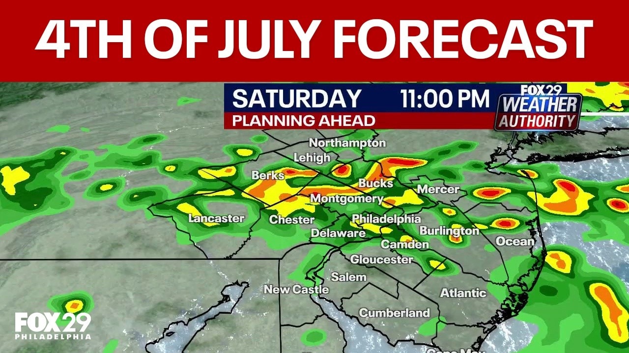
4th of July forecast: Storms to threaten evening fireworks shows
4th of July will end with a bang, but it won't be from fireworks! Forecasters expect a cluster of strong storms to move across the Philadelphia area on Saturday night, bringing damaging wind gusts and rumbles of thunder in some places.
The humid weather could churn up another round of late-day storms which could impact outdoor celebrations and firework shows.
Severe thunderstorm warning
What we know:
The National Weather Service in Mount Holly, New Jersey, has issued a severe thunderstorm warning for Philadelphia, Montgomery, Bucks, Delaware, Chester, and Berks counties until 9:30 p.m. Saturday, July 4.
Radar indicated severe thunderstorms moving east at 40 mph, with hazards including 60 mph wind gusts and penny-size hail.
The National Weather Service says strong winds may occur ahead of any rain, and damage to roofs, siding, trees, and power lines is possible.
Radar indicated the storms were located along a line from near Fleetwood to Cedarville to near Downingtown to Homeville, moving east at 40 mph.
The warning covers Philadelphia, Camden, West Chester, Bensalem, Norristown, Chester, Pottstown, Phoenixville, Lansdale, West Norriton, East Norriton, Coatesville, Yeadon, Westtown, Quakertown, Perkasie, Doylestown, Byram, Downingtown, and Conshohocken.
People at Southampton Days, Lemon Hill, Philadelphia Stadium, and Quakertown Community Day are advised to seek safe shelter immediately.
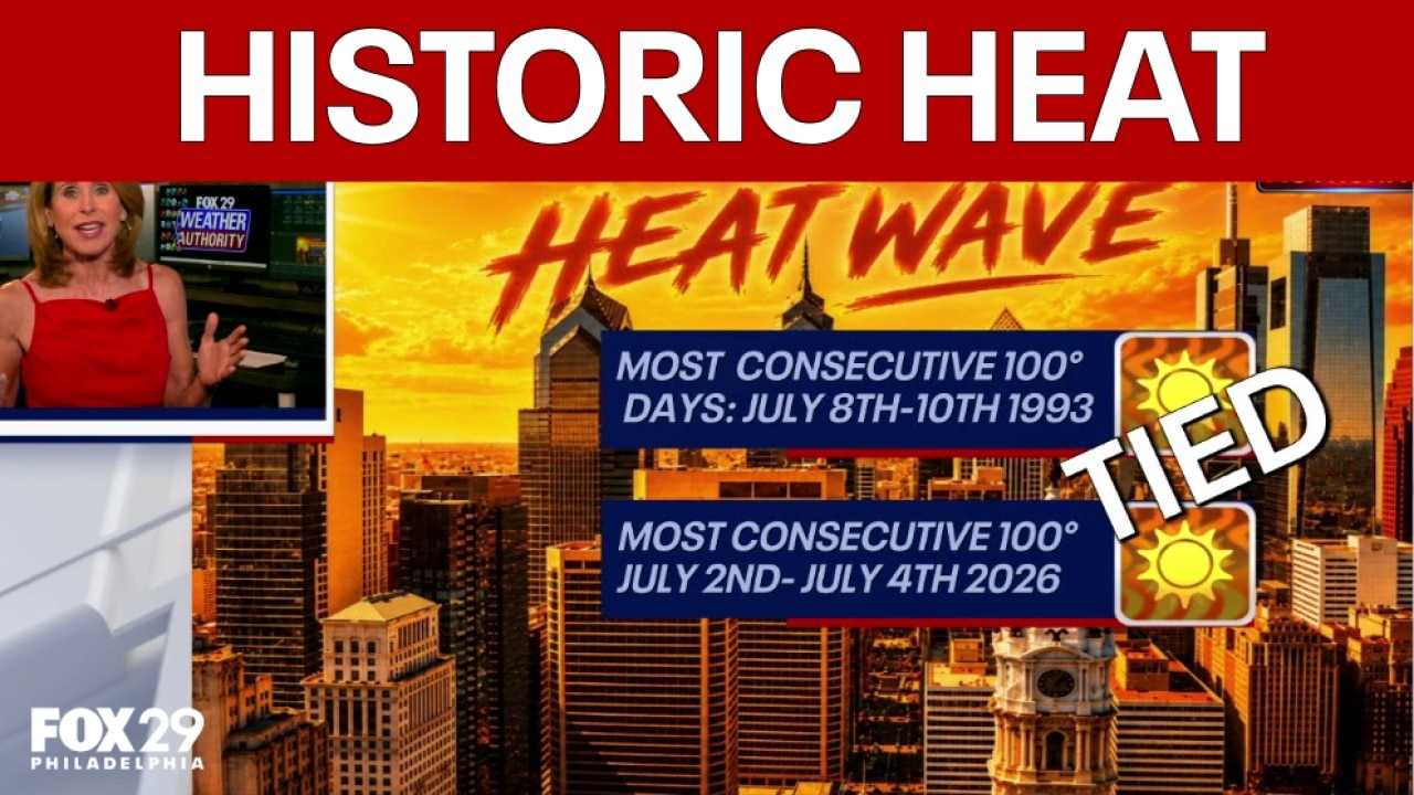
Philadelphia breaks 101° streak record: 4th of July Weekend Forecast
FOX 29 Meteorologist Kathy Orr has the latest in weather as Philadelphia recorded three straight days of 101°F or higher, a first since records began in 1873, according to the NWS.
Philadelphia hit 101° for the third straight day, a first in recorded history, according to the National Weather Service.
An extreme heat warning remains in effect until 8:00 p.m. for the region, with heat index values up to 110° expected.
Atlantic City Airport tied its all-time record high of 106°, and a code orange air quality alert has been issued for Sunday, July 5.
Forecasters expect daytime temps in the 90s to stretch above 100 degrees, with added humidity that will make it feel even hotter,
The heat and humidity will combine to make it feel hotter than 100 degrees by noon, and 108 degrees by mid-afternoon.
The mugginess will give way to a round of scattered storms that will impact the Philadelphia area between 7 p.m. and 11 p.m.
The Weather Service says scattered storms could turn severe, bringing damaging winds 60–80 MPH and localized flash flooding.
Philadelphia, and the surrounding areas, are at an enhanced risk of damaging storms.
What's next:
Temperatures will remain steamy on Sunday, but highs will only reach the low 90s with the threat of some evening showers.
Philadelphia is in for a much-needed cooldown beginning Monday, when forecasters say highs won't even reach 80 degrees.
Rain will accompany the cooler temps on Monday and Tuesday, before sun returns by midweek and the possibility of another heat wave.