

Hurricane Dorian: East coast of Florida watches as Category 2 storm crawls along
Florida's east coast waits for Dorian's anticipated turn
If Dorian follows the projected track, it appears the hurricane force winds will remain off shore, but the East Coast could still experience wind speeds between 40 mph and 55 mph.
TAMPA, Fla. - After a day sitting over Grand Bahama Island, Hurricane Dorian was beginning to make its northwestward turn on Tuesday — very slowly.
By 8 p.m. EST, Dorian was about 110 miles east of Cape Canaveral, Florida, and moved about 6 mph, according to the National Hurricane Center. The storm has since weakened to a Category 2 hurricane with maximum sustained winds of 110 mph, which was not necessarily good news, the NHC warned..
RELATED: Dorian isn't moving because the upper atmosphere is too calm
"The headline for this Dorian advisory is NOT that the wind speed has slightly decreased. The combined wind, surge, and floods hazards are the same or even worse since the hurricane has become larger," the NHC update noted.
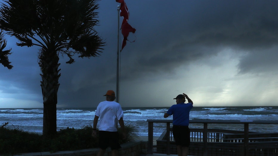
Two men observe an approaching squall caused by hurricane Dorian which is looming in the Atlantic Ocean on September 3, 2019 in Ormond Beach, Florida. (Photo by Mark Wilson/Getty Images)
Hurricane-force winds extend out about 45 miles from the storm's eye, with the strongest winds remaining on the east side of the storm.
Through the past two days, Freeport, Bahamas, has mainly stayed just west of Dorian's eye, and had not had a break from its winds, explained FOX 13's meteorologist Dave Osterberg.
"It's been blowing and blowing and blowing in Freeport now for 24 to 36 hours," he said. "I don't know what kind of structures and trees...that can withstand that type of wind for that long of period of time.“
At least seven people died and 21 injured people were airlifted to the capital by the U.S. Coast Guard, Bahamas officials said late Tuesday.
RELATED: Video shows devastating winds thrashing Bahamas during Hurricane Dorian
Remaining stationary for over a day is ultimately what caused Dorian to weaken from a Category 5 hurricane to a Category 3, Osterberg said.
"These storms need warm, warm water and it's using all the surface water to keep it up," he explained. "As it's using all that water, water from underneath comes up and it's cooler down below... It just causes the storm to weaken.“
RELATED: Hurricane Dorian: Woman in Bahamas houses nearly 100 dogs to protect them from storm
On Monday, the high pressure system that was steering Dorian last week broke down, as expected. While the latest projections show a landfall in Florida remains unlikely, meteorologists stressed that until the northerly turn occurs, residents and visitors should continue to monitor the storm's path.
A trough moving across the U.S. will ultimately become the steering mechanism that will pull Dorian northwest later in the day on Tuesday, then north, then off to the northeast, bringing it uncomfortably close to the east coast of Florida, according to computer models.
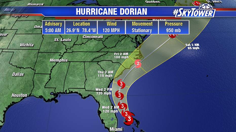
An updated model shows Dorian's projected track, as of Tuesday. (Photo credit: FOX 13 News)
The forecast keeps it offshore, with all of Florida completely removed from the cone of uncertainty.
"I don't think wind is going to be an issue for the East Coast," Osterberg explained. "I think it's going to be the water, just like it was with Hurricane Matthew a couple of years ago.“
If Dorian follows the projected track, it appears the hurricane force winds — of at least 74 miles per hour — will remain off shore, but the East Coast could still experience wind speeds between 40 mph and 55 mph.
There is the potential for the Dorian to not make landfall in the lower 48, but there will still be storm surge along the east coast of Florida, Georgia, and the Carolinas.
Beach erosion and coastal flooding are likely.
Dorian is now tied for the strongest Atlantic hurricane landfall on record with the 1935 Labor Day hurricane. The National Hurricane Center said Dorian made landfall at Elbow Cay, Abacos around 12:40 p.m. Sunday, followed by a second landfall at 2 p.m. on Great Abaco Island near Marsh Harbour.
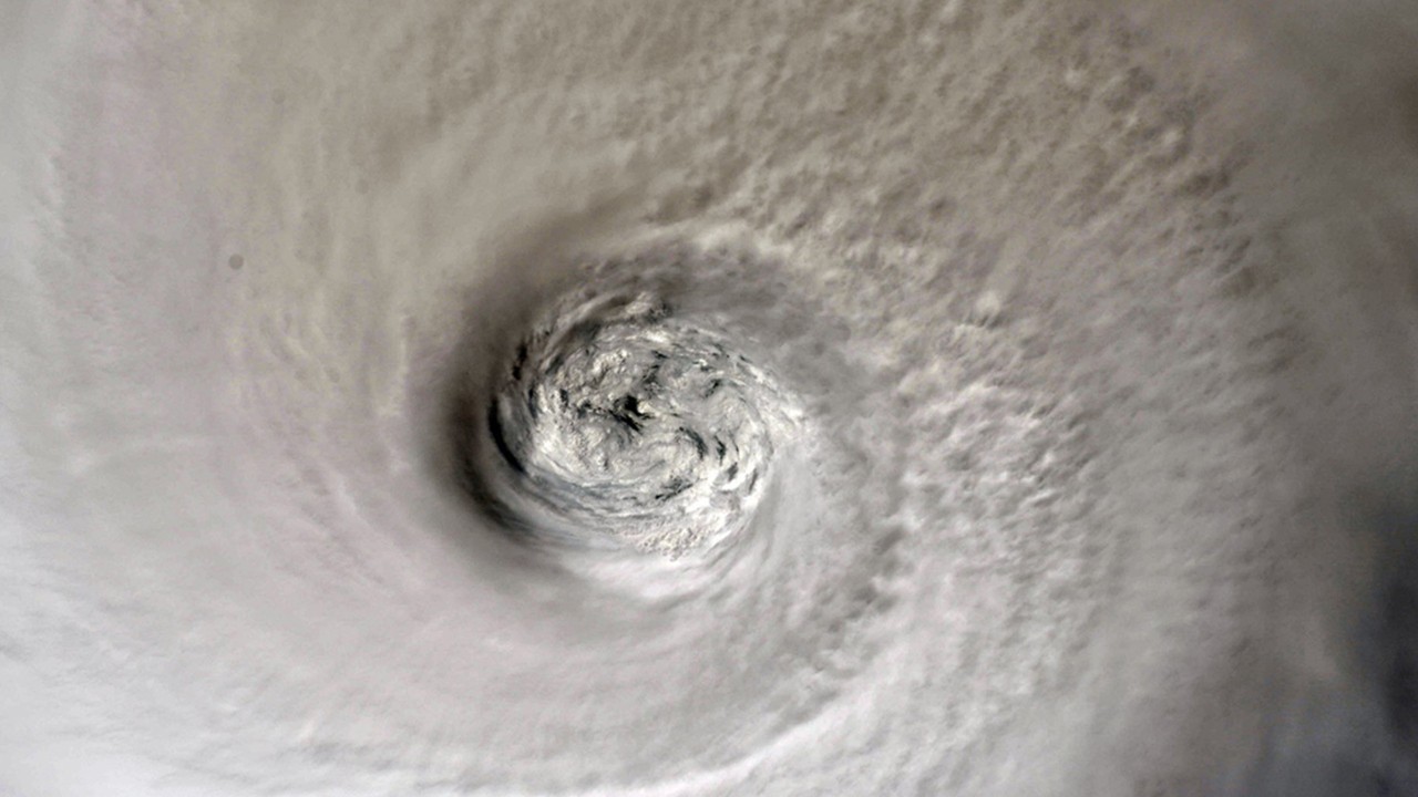
RELATED: NASA satellites provide 3-D view of Hurricane Dorian's clouds from space as storm strengthens
The Associated Press contributed to this report.