

Tornado warning issued as severe storms bring risk of hail, damaging winds to Philadelphia area
PHILADELPHIA - A strengthening storm system is moving through the Delaware Valley and into the Northeast Thursday afternoon, prompting a tornado watch for most of the area through 7 p.m.
The National Weather Service says the storm system brings a risk of damaging wind gusts, hail and an isolated tornado, with temperatures expected to drop sharply on Friday and through the weekend.
Tornado Warning
According to the National Weather Service, a Tornado Warning has been issued in Burlington County until 4:15 p.m.
Severe weather threat and expected impacts
What we know:
Severe thunderstorm warnings and flash flood warnings have been issued for areas in Pennsylvania, New Jersey and Delaware, according to the National Weather Service in Mount Holly. as storms begin to move in. Check the latest watches and warnings here, or click the map below.
Trained weather spotters reported large hail and damaging wind gusts, including quarter- to half dollar-sized hail along with gusts up to 60 mph.
The storms have impacted locations including Philadelphia, Camden, Gloucester City, Cherry Hill, and Bensalem. Rapid rainfall and frequent cloud to ground lightning are creating hazardous conditions for drivers and residents. The National Weather Service says flash flooding is occurring or expected in urban areas, low-lying roads and near creeks and streams.
Timeline:
Warnings began early Thursday afternoon, with several severe thunderstorm warnings issued between 2:45 p.m. and 3:00 p.m.
A few embedded thunderstorms are also possible, especially as the storm system consolidates off the New Jersey coast.
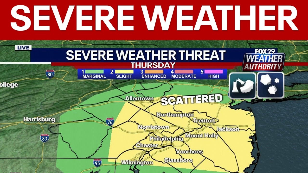
Thursday's severe weather threat increases with damaging winds, hail possible
FOX 29's Scott Williams has the latest on Thursday's forecast as the threat of severe weather increases.
After the severe weather risk on Thursday, colder air is forecast to move in, especially Friday into Friday night. Snow may occur across the higher elevations of the Pocono Plateau, with less than 1 inch expected. Other areas will mostly see rain.
The tornado watch and related warnings are expected to remain active until 7:00 p.m.
The storm system is moving northeast at speeds of 20 to 30 mph and has a history of producing large hail.
Scattered severe thunderstorms are possible across the heart of the Delaware Valley Thursday afternoon, rated as a level 2 threat on a scale of 1 to 5, according to the NWS. There is also some potential for an isolated brief tornado due to atmospheric conditions showing some spin and shear.
The primary threat will be localized damaging winds with occasional hail, mostly during the afternoon hours. Any severe thunderstorms are expected to move northeast, affecting areas up the I-95 corridor, while heavy rain is possible in Lancaster and Berks counties.
Cold temperatures and lasting effects
What's next:
Colder air is forecast to move in behind Thursday's severe weather, especially on Friday and into the weekend. Snow may fall across higher elevations of the Pocono Plateau, with less than 1 inch expected. Other areas will mostly see rain. The National Weather Service reports high temperatures Friday and Saturday will stay in the 40s, with overnight lows dropping into the 20s and low 30s.
Wind gusts up to 30 mph are possible Saturday, and frost or freeze advisories could be needed for locations where the growing season is still active. The strongest winds are expected Saturday before tapering off on Sunday. Some warming is forecast early next week, but high temperatures should remain in the upper 40s or low 50s.
By the numbers:
Rainfall north of the Pennsylvania Turnpike to the I-195 corridor is expected to be between 0.50 and 1.25 inches. Areas south of Philadelphia and further south are expected to receive less than 0.50 inches, and the southern Delmarva region may get less than 0.10 inch of rain.
The strongest winds are expected Saturday with gusts up to 30 mph before tapering off Sunday. Despite a bit of warming Sunday through Tuesday, high temperatures are forecast to stay in the upper 40s to low 50s.
Storm outlook and safety alerts for residents
What you can do:
Residents and commuters in the affected areas have been advised to move to interior rooms on the lowest floor of buildings for protection.
Rainfall north of the Pennsylvania Turnpike to the I-195 corridor is expected to reach between 0.50 and 1.25 inches, with lower totals further south. Most precipitation is anticipated to arrive on Thursday afternoon, with the risk for more moderate to heavy showers embedded with thunderstorms.
What we don't know:
The amount of snow accumulation in the higher elevations and the full extent of rainfall across the region remain unclear, as they depend on the final track of the storm. The precise location and need for additional frost or freeze advisories will depend on weekend temperature changes.
The Source: This article contains information from the FOX 29 Weather Authority and the National Weather Service.