

Study finds 17.5 million Americans at highest risk of coastal flooding: Here's where

Vehicles drive through high water on NC highway 321 on September 27, 2024 in Boone, North Carolina. Rains from what was Hurricane Helene have dropped more than a foot of rain across much of the region. (Photo by Melissa Sue Gerrits/Getty Images)
A sweeping new study finds that more than 17 million people living along the U.S. Atlantic and Gulf coasts face the highest risk of flooding, with New York and New Orleans among the most vulnerable.
Methodology:
Researchers at the University of Alabama used 16 different factors including the geographic hazards, the population and infrastructure exposed and the vulnerability of people living there. They then brought in past damages from the Federal Emergency Management Agency's database and applied three different artificial intelligence tools to figure out flood risks from Texas to Maine, calculating that 17.5 million people were at "very high" risk and an additional 17 million were at "high" risk, the next level.
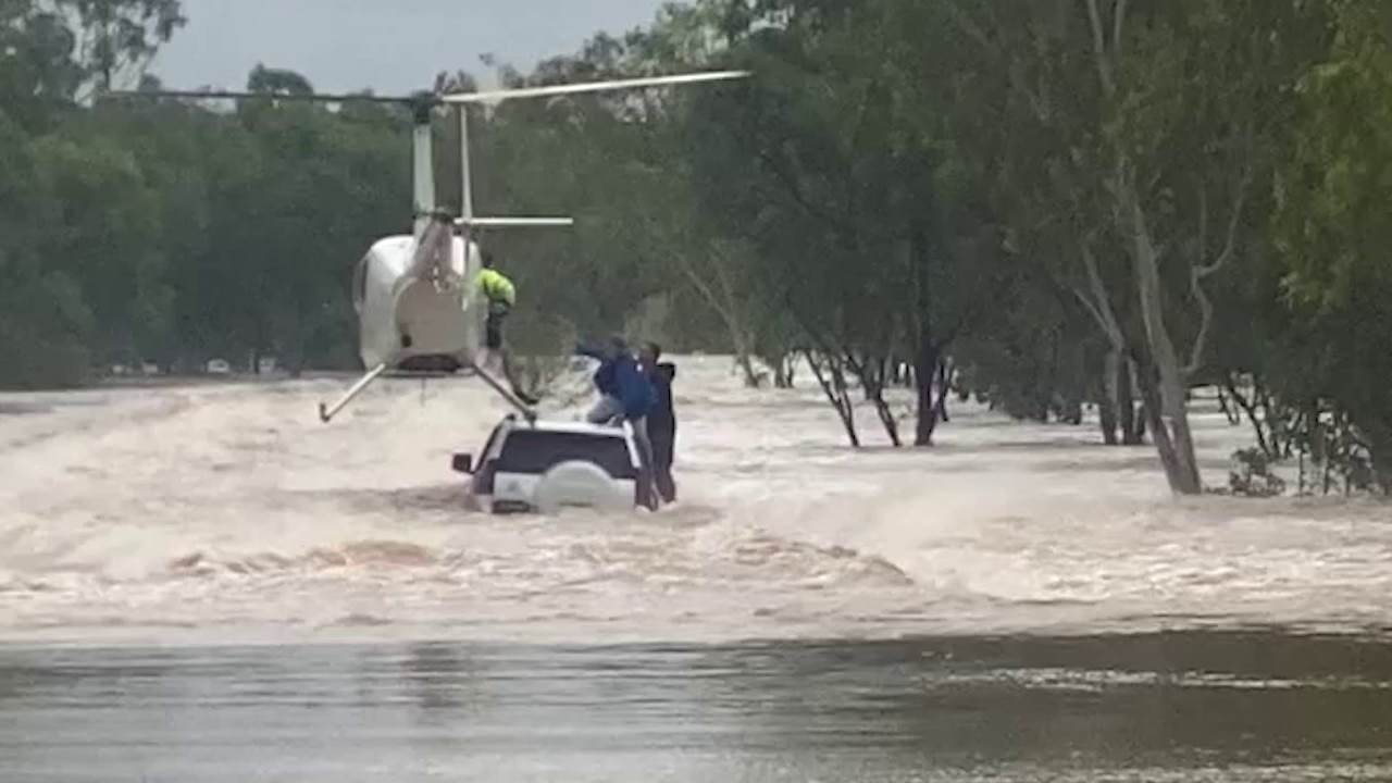
Pilot lands helicopter on vehicle, saves men and dog from floodwaters
A daring helicopter rescue saved two men and their dog stranded on a flooded vehicle in Australia’s Northern Territory as dangerous storms triggered major flood warnings. (Credit: Northern Territory Police Force via Storyful)
By the numbers:
The authors looked at all sizes of flooding and examined separately what FEMA considers the most extreme, which are the top 1% of events. The study found 4.3 million people along the coasts to be at the highest level of risk of extreme flooding, but 20.5 million to be at high risk, the second highest level.
RELATED: Wildfire in Georgia underscores climate change impact in Eastern US
They found a lot of vulnerability, highlighting eight different cities from Houston, which flooded in 2017’s Hurricane Harvey, to New York, which was inundated in 2012’s Superstorm Sandy.
Wednesday's study in the journal Science Advances found that New York City has 4.75 million people at the two highest risk levels for all flooding, with more than 200,000 buildings likely to be damaged.
And while the number of people at risk in New Orleans is far lower, about 380,000, it involves 99% of the city's population. That doesn't mean 99% of the people will be affected in the next hurricane or nontropical flood, but that they might be depending on the storm's individual path and rain pattern, said study co-author Wanyun Shao, a climate scientist at the University of Alabama.

Railroad tracks suspended in air in Vermont after flooding
The day after the catastrophic flood in Ludlow, Vermont, is seen in drone video captured by Pat Moore on Tuesday, July 11, 2023.
What they're saying:
"When the next big storm hits New York City, when the next Hurricane Katrina -like hurricane makes landfall in New Orleans, people will get hurt, especially those socially vulnerable populations," Shao said referring to the poor, the elderly, children and the uneducated.
Shao and outside experts said the numbers stunned them even though they were familiar with the worsening effects of climate change.
RELATED: These are the fastest-warming US states, according to data
"New York is known to be susceptible to floods and it has the largest population. But the fact that New York has nearly an order of magnitude more flood-exposed population than any other city is surprising," said Alex de Sherbinin, a geographer who directs Columbia University’s Center for Integrated Earth System Information. He wasn’t part of the study.
Big picture view:
Jacksonville has 679,000 people at high or very high risk of flooding, while Houston is just behind at just under 600,000. Other cities highlighted include Miami, Norfolk, Virginia, Charleston, South Carolina, Mobile, Alabama.
What you can do:
Study lead author Hemal Dey, a geospatial scientist, said he hopes local officials look at not just building more dams and levees, but more natural infrastructure such as wetlands, grasslands, rain gardens and estuaries.
"The research is solid confirmation of what emergency managers have been saying for years. Realtors will hate it,'' said Craig Fugate, a former FEMA director who wasn't part of the study. "The harder question is what we’re actually going to do about it."
The Source: The information in the story comes primarily from a comprehensive study conducted by researchers at the University of Alabama and published in the journal Science Advances. This story was reported from Los Angeles.