

First fall nor’easter to bring wind and rain to Philly, dangerous surf to Jersey Shore

Rain and cooler temperatures expected as fall approaches in Philadelphia
A passing storm system is bringing humid conditions and showers to the region before drier, cooler air moves in overnight. High temperatures will drop into the sixties this week as fall officially begins on Tuesday, with additional chances for rain over the next several days.
PHILADELPHIA - Get the rain gear ready and hold off on any late-season trips to the shore.
The first fall nor'easter is set to bring a soggy, windy workweek to the Philadelphia area while battering the nearby coastline through the weekend.
What we know:
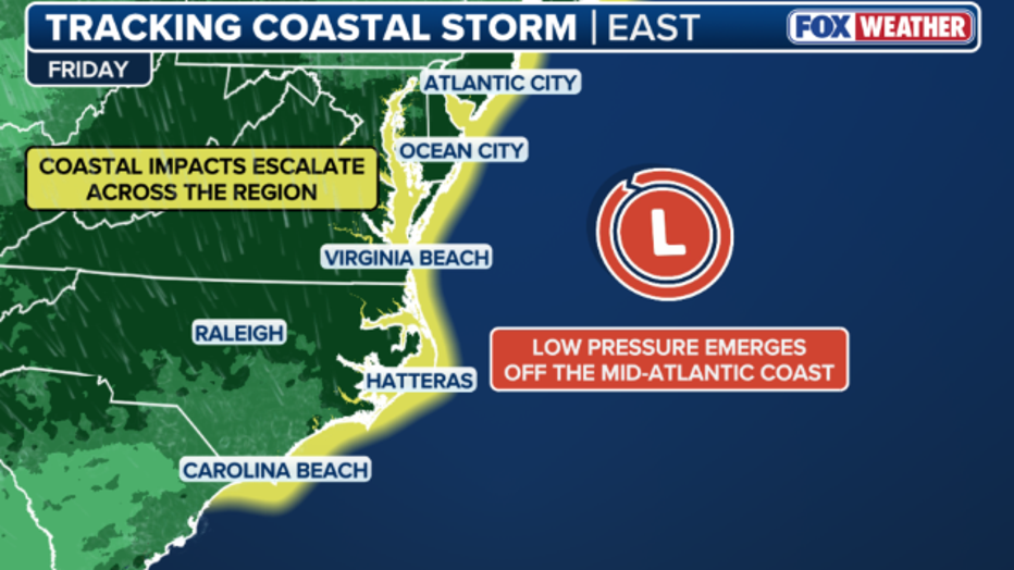
According to FOX Weather, a sharp fall cold front is pushing off the coast this week, colliding with strong high pressure to the north.
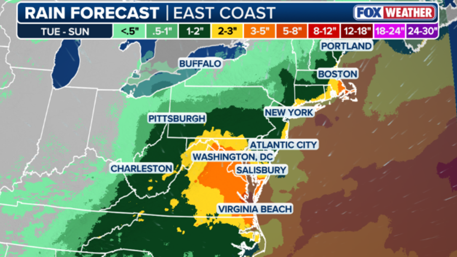
For those in the Philadelphia region, this means days of gusty winds and persistent rain. However, the most severe impacts will be felt just east of the city.
Local perspective:
While Philadelphia will deal with messy commuting conditions, the Jersey Shore and Delaware beaches are bracing for a major coastal event.
Here's what to expect at the shore:
- Severe beach erosion: Persistent onshore winds will remain locked in through multiple high-tide cycles, pounding coastal dunes. Dune washouts and damage to boardwalks are increasingly likely.
- Coastal flooding: Water is expected to become trapped in back bays, preventing full drainage during low tides. Moderate coastal flooding is anticipated, especially on low-lying roadways.
- Dangerous surf: Offshore waves could reach heights of 15 to 18 feet, creating deadly rip currents and massive swells.
Timeline:
Experts say the surface low-pressure system will track north by the weekend. Depending on its exact path, Philadelphia could see intensifying winds and heavier rain bands.
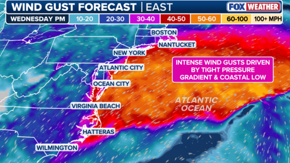
Residents with property down the shore are urged to monitor the forecast closely, as wind gusts along the immediate coast could reach 40 to 50 mph, pushing ocean water inland and causing elevated tidal flooding across New Jersey and Delaware.
The Source: Information from this article was sourced from FOX Weather.