

Coastal storm to bring flooding, intense winds to New Jersey, Delaware beaches
Philadelphia weather: Coastal storm to impact New Jersey, Delaware beaches
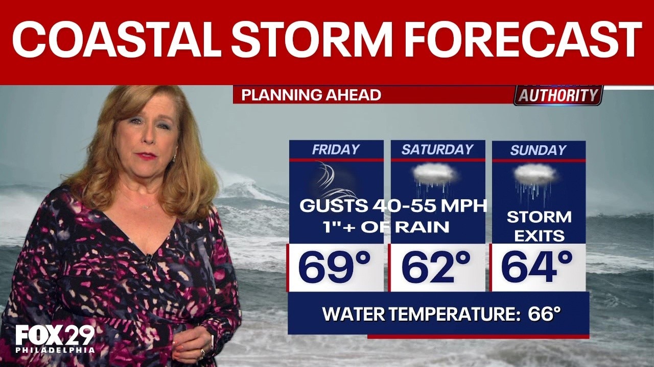
FOX 29's Sue Serio has the latest on the track of a coastal storm that is expected to bring strong winds and flooding to the New Jersey and Delaware beaches this weekend.
PHILADELPHIA - The New Jersey and Delaware beaches are bracing for a coastal storm this weekend that forecasters believe will bring strong wind gusts, drenching rain, and flooding.
Coastal storm to impact New Jersey, Delaware beaches
Timeline:
The severity and duration of rainfall, wind, and flooding for the I-95 urban corridor will depend heavily on the final track of the low-pressure center as it tracks northeast.
For New Jersey and Delaware, forecasters expect the system to approach the coast on Friday night and move inland during the weekend. By Saturday, forecasters expect the low-pressure system to push rain far inland, including Philadelphia and beyond.
Rain and wind will continue on Sunday morning, as the storm swirls up the coast towards New England.

Storm hits North Wildwood: Waves crash, locals react
Large waves and strong winds from a coastal storm hit North Wildwood, raising concerns about beach erosion and the impact on Irish Weekend events.
Coastal storm impacts
What we know:
Inland areas surrounding Philadelphia will see gusty conditions, while coastal New Jersey and Delaware face severe marine and coastal flooding hazards.
- Wind hazards: A wind advisory remains in effect along the coast of New Jersey and Delaware through Friday evening for sustained winds of 25–35 mph and gusts up to 50 mph. A high wind watch has been issued for the same coastal zones from Friday night through Saturday. Inland areas, including Philadelphia, can expect maximum wind gusts reaching 25 to 30 mph.
- Coastal flooding and marine warnings: A coastal flood warning covers the coast of New Jersey and Delaware through Friday night. The NWS warns that multiple rounds of minor to moderate tidal flooding will impact the Delaware Bay, southern Raritan Bay, the tidal Delaware River, and back bays such as Barnegat Bay and Indian River Bay. Roadways in low-lying coastal areas may become impassable.
- Surf and erosion: High surf and a high risk of dangerous rip currents will persist through Saturday, with seas reaching 8 to 15 feet. Significant beach erosion and dune breaching remain top concerns along exposed beaches.
Track the coastal storm
What you can do:
Stay ahead of the storm by using the live radar below. You can also download the free FOX LOCAL app for the latest forecasts and updates from the shore throughout the weekend.
The week ahead
What's next:
Showers will linger on Monday before sunshine reemerges later in the day with highs in the low 60s. A mix of clouds and sun is expected on Tuesday as temperatures stretch back into the 70s, beginning a warming trend that could reach 80 degrees by Thursday.
The Source: Information provided by the FOX 29 Weather Authority.