

Philadelphia weather: 83-degree record high, then 30s and wet snow expected Thursday
Philly weather swings: Record high, then rain and wet snow Thursday
Philadelphia set a new record high temperature of 83 degrees on Wednesday, but FOX 29 Meteorologist Scott Williams said the city is about to see a dramatic weather shift with crashing temperatures and a chance for wet snow.
PHILADELPHIA - Philadelphia set a new record high temperature of 83 degrees on Wednesday, but FOX 29 Meteorologist Scott Williams said the city is about to see a dramatic weather shift with crashing temperatures and a chance for wet snow.
Record warmth gives way to wild swings
What we know:
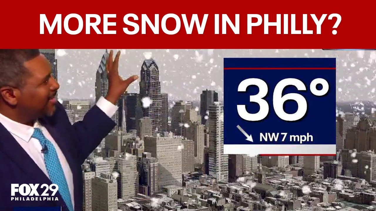
Meteorologist Scott Williams said, "83 degrees new record high temperature today that beat the old record 74 degrees set back in 2021." He explained that a cold front will move in Thursday, dropping temperatures from the 60s in the morning to the 30s by the afternoon.
There could be some rain mixing in with some wet snow.
However, no accumulation is expected since temperatures the past couple of days have been topping out in the 80s.
The severe thunderstorm watch expired early, but thunderstorms with lightning are still moving through parts of Ocean County, Lancaster County, Berks County, and areas around Honeybrook and Coatesville Wednesday night.
Williams described the shift as "weather whiplash," with temperatures tumbling and unsettled conditions continuing through the evening.
Thunderstorms and snow chances across the region
By the numbers:
For Thursday morning, temperatures will be in the 50s but then temps will drop to the 30s by 3 p.m.,
Friday morning will start in the upper 20s, with high temperatures in the low 50s, which is typical for this time of year.
Saturday and Sunday will see highs in the mid-50s, with more sun Saturday and clouds rolling in Sunday for the St. Patrick’s Day parade.
Monday, expect thunderstorms and some showers with temperatures likely back into the 60s.
Williams explained that these wild temperature swings are typical for March, calling it "the battle of the air masses."