

Coastal storm triggers flood advisory, strong winds along Jersey, Delaware shores
PHILADELPHIA - A coastal storm moving up the Mid-Atlantic coast is set to bring gusty winds, rough surf, and significant tidal flooding risks to the Philadelphia region and the Jersey Shore, according to FOX 29 meteorologist Kathy Orr and the National Weather Service.
Widespread Impacts Expected Across the Region

Philadelphia weather: Wednesday evening forecast
FOX 29 meteorologist Kathy Orr looks at current conditions and breaks down the 7-day forecast ahead of this weekend's nor'easter.
What we know:
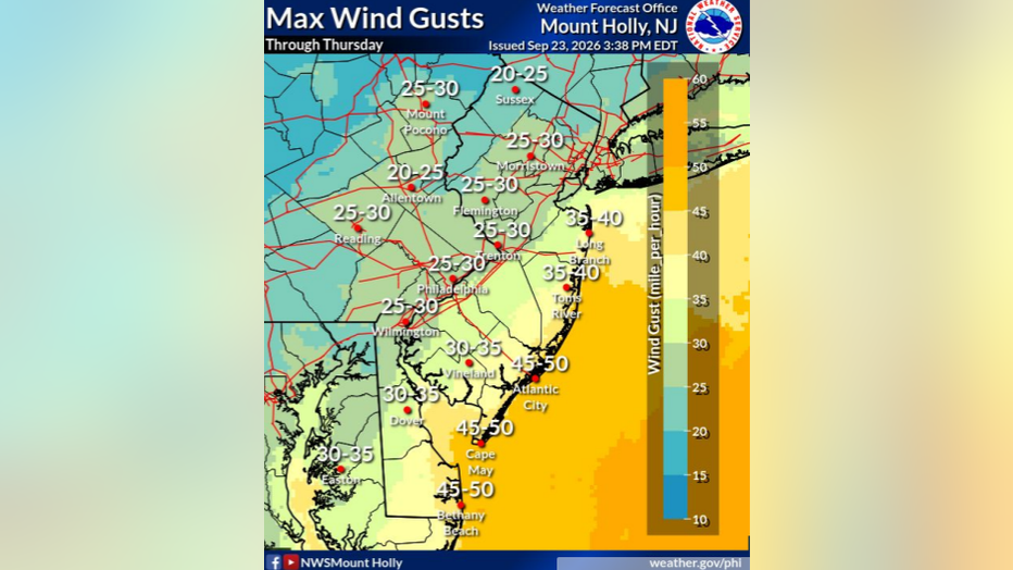
Meteorologists say winds are already gusting up to 30 miles per hour along the shore and are expected to increase by about 10 miles an hour over the next few days, reaching their peak Saturday night into Sunday.
By Sunday, gusts could reach up to 55 miles an hour along the coast and 50 miles an hour in places like Lewes on Saturday.
The National Weather Service warns that a wind advisory remains in effect until 8 p.m. Thursday for New Jersey and Delaware beaches. The advisory predicts northeast winds of 25 to 35 miles an hour with gusts potentially up to 45 miles an hour, which could cause unsecured objects to blow around and a few power outages.
By the numbers:
Local officials expect "one to two feet of inundation above ground level expected in low-lying areas near shorelines and tidal waterways," according to the National Weather Service.
The agencies say moderate coastal flooding will start with Wednesday afternoon’s high tide cycle and could continue through at least Friday night, possibly longer.
For the Delaware River at Philadelphia, minor flooding is expected during high tides Wednesday night and Thursday, with moderate flooding forecast Friday and Saturday mornings. Back bay areas in New Jersey and Delaware, including Barnegat Bay, Shrewsbury River, and Indian River Bay, face some of the most significant tidal flooding risks.
Ongoing Weather Concerns Through the Weekend
What's next:
The coastal storm is expected to develop into a nor’easter by Thursday evening, sitting off the Mid-Atlantic coast and tracking northward toward the Jersey Shore and Nantucket.
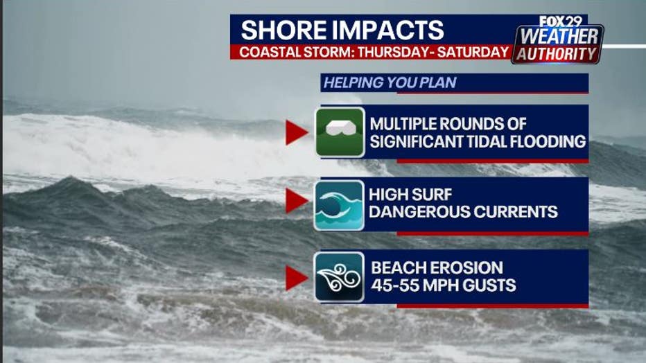
"This is an extended period of time, and that’s why the beach erosion quite possibly could be significant," said Orr.
Forecasters warn of ongoing on-and-off showers, coastal flooding, and "a high risk of rip currents remain active through Saturday," alongside likely "significant beach erosion and the potential for sand dunes to be breached."
The National Weather Service continues to caution residents: "Do not leave your vehicle at a location that is prone to tidal flooding. Do not drive your vehicle through floodwaters. The water may be deeper than you think it is."
Temperatures are forecast to stay in the 60s and low 70s through the weekend, with a brighter and warmer trend possible next week as the upcoming nor’easter pulls away. The full moon on Friday and Saturday will amplify tidal flooding risks.
What we don't know:
Forecasters caution that "a lot of details [are] to sort out," and the exact track and impacts of the developing nor’easter remain uncertain. Models continue to be monitored to determine how close the storm will approach the coast and what areas will see the brunt of flooding and wind.
The Source: This article contains information from FOX 29 meteorologist Kathy Orr, National Weather Service statements and advisories and official forecast materials.