

Nor'easter to batter East Coast with severe flooding, high winds: When to expect the storm

PHILADELPHIA - A developing nor'easter is set to impact millions along the East Coast this week, bringing a multi-day threat of strong winds, pounding surf, and significant coastal flooding through the weekend.
What we know:
As the low-pressure system strengthens off the Mid-Atlantic, major metro areas including New York City, Philadelphia, and Washington D.C. are bracing for persistent onshore winds, dangerous marine conditions, and widespread tidal flooding that will rapidly intensify during high tide cycles.
When will the storm hit?
Timeline:
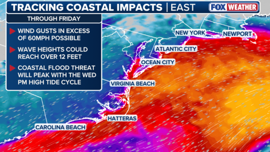
Coastal impacts are expected to begin mid-week, with tidal flooding starting Wednesday afternoon across the Delaware and Chesapeake Bay regions, expanding down to the Virginia Tidewater by Wednesday night. Strong onshore winds will build through Thursday, pushing water inland and causing hazardous ocean conditions along the Mid-Atlantic coastline.
The storm will intensify as it moves toward the I-95 corridor Friday into Saturday, bringing peak wind gusts of 35 to 50 mph and high ocean swells to the region. Widespread coastal flooding is expected to peak during high tides from Friday into Saturday, creating a threat of severe beach erosion and dune damage for coastal areas surrounding New York City, Philadelphia, and Washington D.C. before the system gradually moves out through the weekend.
Featured
What is a nor'easter? How they form and what to expect
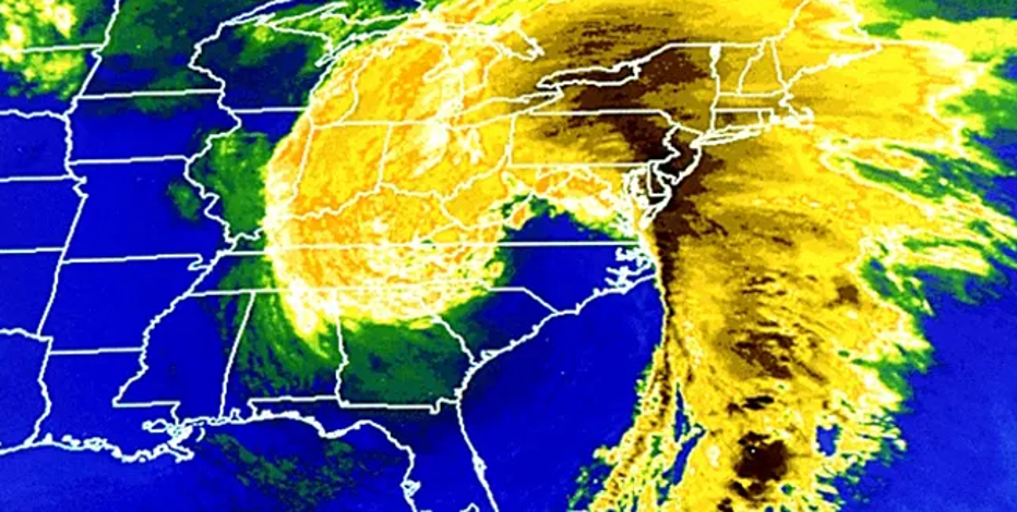
Despite popular belief, snow is not a requirement for a nor'easter. Here's how the East Coast's biggest storms form.
New York City forecast
Local perspective:
New York City and its surrounding areas are bracing for persistent winds and widespread minor to locally moderate coastal flooding.
Flooding risk: Tidal piling combined with high tides may lead to multiple cycles of coastal flooding, peaking Friday into Saturday. Southern Nassau, Queens, and coastal Connecticut west of New Haven face the highest risk. If the storm shifts closer to New Jersey or Long Island, New York City will remain on the storm's outskirts.
Winds: Wind gusts of 35–50 mph are expected Friday into the weekend across the broader region. Forecasts for New York City show maximum wind gusts ranging from 26 to 32 mph Wednesday through Friday, increasing to 36 mph on Saturday. JFK Airport is forecast to see gusts up to 38 mph on Friday and Saturday.
Marine hazards: Small craft advisories are active for non-ocean waters through Thursday, while a storm watch takes effect for offshore ocean waters Thursday night and Friday. Near-shore ocean seas will reach 7 to 10 feet, peaking Friday into Saturday.
Philadelphia forecast
Local perspective:
The Philadelphia region will face multiple rounds of tidal flooding, heavy surf, and windy conditions as the coastal storm approaches.
Coastal flooding: Moderate coastal flooding is expected to begin with Wednesday afternoon's high tide cycle. Impacts will hit portions of the Atlantic coast, the tidal Delaware River, Delaware Bay, Chesapeake Bay, and southern Raritan Bay. The most significant tidal flooding is projected for back bay areas, including New Jersey's Barnegat Bay and Shrewsbury River, and Delaware's Indian River Bay.
Winds: A wind advisory is in effect through 8 p.m. Thursday for the Atlantic coasts of New Jersey and Delaware, warning of winds at 25–35 mph and possible gusts up to 50 mph. Gale conditions on coastal waters are forecast through Thursday night and may persist into Friday or Saturday.
Beach hazards: A high surf advisory and a high risk of rip currents remain active through Saturday. Forecasters warn of likely significant beach erosion and the potential for sand dunes to be breached.
DC forecast
Local perspective:
The D.C. area and the surrounding Chesapeake region are navigating inland water push and precipitation.
Coastal flooding: Persistent onshore winds threaten to trap water in the lower Chesapeake Bay. A coastal flood advisory is active for the D.C. area, where the primary threat is ocean water pushing inland rather than just rainfall.
Erosion and rain: The nor'easter presents a risk of significant coastal erosion for the D.C. area. The region has already experienced a soaking rain event, with the possibility of additional precipitation accumulation into Wednesday.
The Source: Information from this article was sourced from FOX Weather and the National Weather Service.