

Developing nor'easter keeps East Coast on high alert as coastal communities prepare
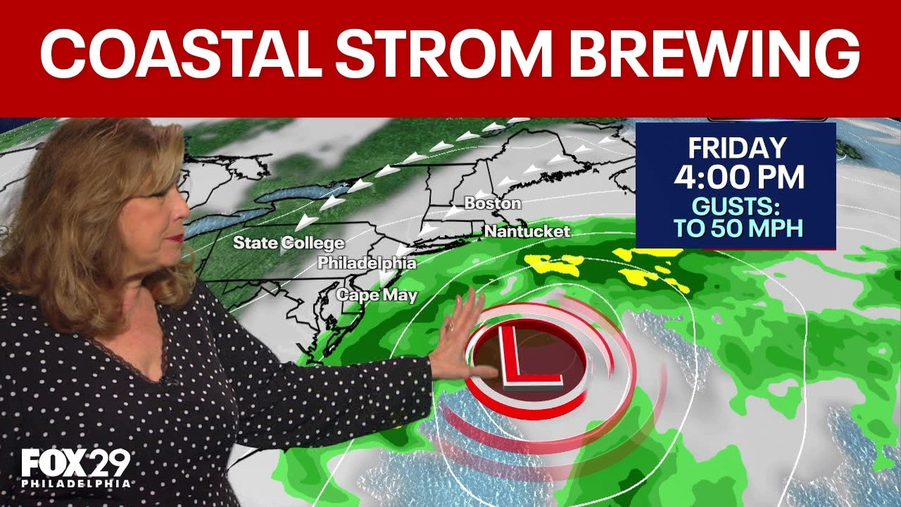
NJ, Delaware coastal storm: Brewing nor'easter to bring strong winds, flooding concerns
Forecasters are warning of a developing nor'easter that could bring damaging winds and flooding concerns from the Jersey shore to the Delaware beaches.
PHILADELPHIA - A powerful early-season nor’easter developing off the Mid-Atlantic coast is threatening millions along the I-95 corridor with days of coastal flooding, battering waves and persistent, gusty winds.
While the system's exact track into the weekend remains uncertain, the Northeast region is already feeling the brunt of increasing coastal hazards.
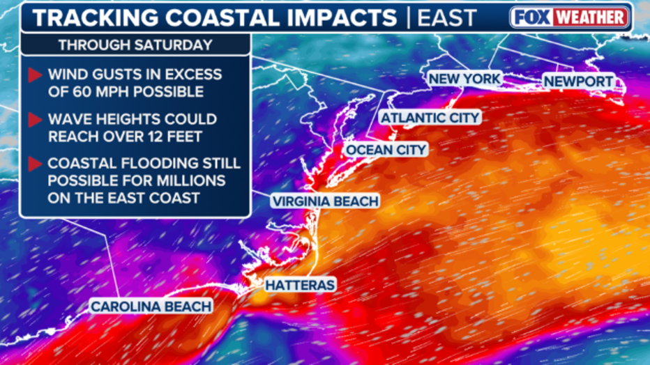
Weekend Track Uncertainty
What we know:
The severity and duration of rainfall, wind, and flooding for the I-95 urban corridor will depend heavily on the final track of the low-pressure center as it tracks north-east. Meteorologists are tracking three primary potential outcomes:
- New Jersey / Long Island track: If the low shifts closer to New Jersey or Long Island, heavy rain and the strongest wind gradients could move further south, putting New York City and surrounding coastal zones directly under significant impact.
- New England / Boston track: If the storm tracks further north toward southern New England, Boston and the Massachusetts coast would face the worst impacts, including 60 to 70 mph wind gusts, major storm surges, and localized flash flooding. The Mid-Atlantic would see lingering tidal flooding and breezy conditions.
- Offshore drift: If the low moves further east out to sea, heavy rain and severe winds will remain over open waters, though back-bay flooding and elevated surf will still linger along the coast.
Local forecasts
Local perspective:
Here is how the developing storm is projected to impact the areas of Washington, D.C., Philadelphia and New York City.
Philadelphia, South Jersey and Delaware
Inland areas surrounding Philadelphia will see gusty conditions, while coastal New Jersey and Delaware face severe marine and coastal flooding hazards.
- Wind hazards: A wind advisory remains in effect along the coast of New Jersey and Delaware through Friday evening for sustained winds of 25–35 mph and gusts up to 50 mph. A high wind watch has been issued for the same coastal zones from Friday night through Saturday. Inland areas, including Philadelphia, can expect maximum wind gusts reaching 25 to 30 mph.
- Coastal flooding and marine warnings: A coastal flood warning covers the coast of New Jersey and Delaware through Friday night. The NWS warns that multiple rounds of minor to moderate tidal flooding will impact the Delaware Bay, southern Raritan Bay, the tidal Delaware River, and back bays such as Barnegat Bay and Indian River Bay. Roadways in low-lying coastal areas may become impassable.
- Surf and erosion: High surf and a high risk of dangerous rip currents will persist through Saturday, with seas reaching 8 to 15 feet. Significant beach erosion and dune breaching remain top concerns along exposed beaches.
New York City and Long Island
The New York City metropolitan area and Long Island are preparing for a prolonged period of adverse coastal weather starting Friday and lasting through the weekend.
- Wind and rain: NWS highlights a trend toward a significant coastal storm impacting the region Friday into Sunday. Prolonged gusty winds will build on Friday and peak early Sunday, accompanied by periods of rain.
- Tidal flooding: Widespread minor to locally moderate coastal flooding is anticipated during high tide cycles Friday into Saturday. The highest threat for widespread moderate flooding targets southern Nassau County during Friday evening and Saturday morning high tides.
- Beach conditions: Dangerous rip currents and heavy surf are expected along local ocean beaches, leading to elevated beach erosion risks throughout the weekend.
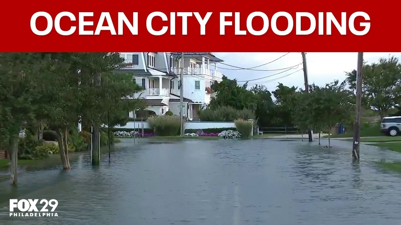
Ocean City flooding: Approaching coastal storm floods streets at Jersey shore
Ocean City is already feeling the effects of an approaching coastal storm that is expected to bring strong winds and flooding.
DMV
For the Washington, D.C., metro area and surrounding parts of Maryland and Virginia, the core of the storm is expected to remain largely offshore, keeping conditions drier than areas further north.
- Precipitation: According to the National Weather Service, conditions across the region will remain mostly dry, though a few passing showers cannot be ruled out as the storm makes its closest approach over the weekend.
- Wind and tidal flooding: Breezy conditions will persist through the weekend, particularly east of I-95. A persistent onshore flow combined with the developing low-pressure system is driving higher water levels into the Chesapeake Bay and the tidal Potomac River. Minor to moderate flooding will affect sensitive coastal locations through the end of the workweek before water levels begin dropping early next week.
- Coastal Maryland and Virginia: Coastal areas of Maryland and Virginia could experience some of the region's worst tidal flooding, pushed inland by wind gusts between 40 and 50 mph.
The Source: Information from this article was sourced from FOX Weather and the National Weather Service.