

February 2026 blizzard totals: How much did it snow across the Northeast US?
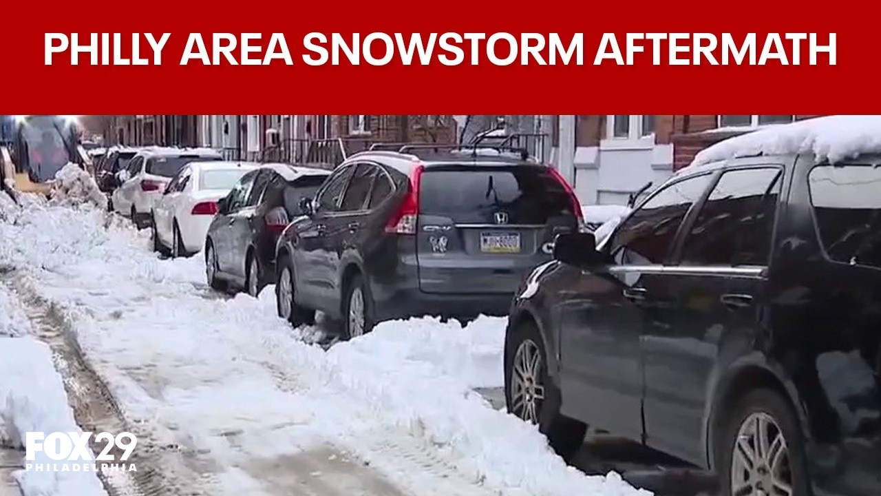
How Philly, Bucks, and South Jersey are digging out after snowstorm
Residents across South Philly, Bucks County, and South Jersey are digging out after a major snowstorm, with city and county crews working to clear roads and restore normalcy.
PHILADELPHIA - A major nor’easter that intensified offshore brought heavy snow and strong winds across a wide stretch of the Northeast, leaving a broad range of storm totals from Virginia and the DC region to New York, New Jersey and Connecticut.
What we know:
The storm produced blizzard-like conditions in parts of the region and dumped significant snow across multiple states. Peak storm totals by state included 14 inches in Virginia, 16 inches in Maryland, 21 inches in Delaware, 22.1 inches in Pennsylvania, 30.7 inches in New Jersey, 31 inches in New York and 30.8 inches in Connecticut.
FIND THE LATEST WINTER WEATHER FORECAST HERE

Pennsylvania
Parts of the Philadelphia region reported snowfall well into the teens.
- Northeast Philadelphia: 16.0 inches
- Philadelphia International Airport: 14.0 inches
- Fox Chase: 14.8 inches
- Norristown: 13.4 inches
- Willow Grove: 13.2 inches
- Skippack: 12.8 inches
RELATED: What are the biggest snowstorms in Philadelphia area history?

Snow in Willow Grove, PA Feb. 23, 2026. (Photo: Tyler Thrasher/FOX)
New Jersey
Snow totals exceeded 2 feet in several New Jersey communities.
- Moonachie: 24.3 inches
- Ridgefield: 23.2 inches
- Leonia: 22.0 inches
- Carlstadt: 21.4 inches
- Orange: 24.0 inches
- Montclair: 19.0 inches
- Kearny: 19.0 inches
- Hoboken: 18.5 inches
- Newark Airport: 18.3 inches
- Freehold: 26.0 inches
- Middletown: 25.0 inches
- Perth Amboy: 25.0 inches

NEW YORK, NEW YORK - FEBRUARY 23: A man carrying flowers walks through the snow in the Lower East Side on February 23, 2026 in New York City. A major winter storm has hit the Northeast and Mid-Atlantic regions bringing heavy snowfall and blizzard con
Delaware
Delaware recorded widespread double-digit snowfall totals.
- Woodside: 20.5 inches
- Dover: 16.5 inches
- Felton: 17.5 inches
- Wilmington: 9.5 inches
- Hockessin: 10.0 inches
- Long Neck: 19.3 inches
- Delaware Coastal Airport: 19.0 inches
- Lewes: 18.0 inches
Stay connected with FOX LOCAL. For 24/7 winter storm coverage—Download Now.
New York
Snow totals across New York City and Long Island ranged from the mid-teens to more than 2 feet.
- Mott Haven (Bronx): 17.9 inches
- Co Op City (Bronx): 14.8 inches
- Sheepshead Bay (Brooklyn): 20.5 inches
- Bay Ridge (Brooklyn): 16.9 inches
- Washington Heights (Manhattan): 18.9 inches
- Central Park (Manhattan): 15.1 inches
- Jackson Heights (Queens): 17.0 inches
- LaGuardia Airport: 15.1 inches
- JFK Airport: 15.0 inches
- Grasmere (Staten Island): 24.1 inches
- Remsenburg-Speonk (Long Island): 27.5 inches
- Central Islip: 27.0 inches
- Islip Airport: 22.5 inches
RELATED: What are the biggest snowstorms in NYC area history?
Connecticut
Connecticut communities reported widespread totals in the teens, with some nearing or exceeding 20 inches.
- New Fairfield: 18.0 inches
- Bridgeport Airport: 16.0 inches
- Madison: 19.9 inches
- New Haven: 16.0 inches
- Ledyard Center: 20.0 inches
- Mystic: 18.5 inches
Virginia
Snow totals varied across Northern Virginia, with higher amounts in some western suburbs.
- Reston: 4.5 inches
- Falls Church: 3.5 inches
- Dulles International Airport: 2.0 inches
- Reagan National Airport: 1.0 inch
Washington, D.C.
Accumulations in the District remained relatively modest compared to areas north and east.
- Catholic University: 3.6 inches
Maryland
Maryland saw a wider range of snowfall totals, with double-digit amounts in some communities.
- Long Green (Baltimore County): 5.1 inches
- Damascus (Montgomery County): 7.1 inches
- Sabillasville (Washington County): 12.3 inches
RELATED: What are the biggest snowstorms in DC area history?
What we don't know:
Snow totals can shift as National Weather Service offices and local spotters complete final storm surveys, and as drifting is factored into measurements in wind-prone areas. Some community reports may also be updated as additional observations come in.
RELATED: How to shovel snow without a shovel
Philadelphia weather: Mild temps will help melt leftover snow
Mild temperatures in the days ahead will help melt inches of snow leftover from Monday's blizzard.
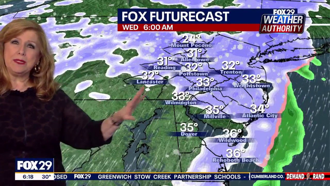
Light flurries Wednesday; mild air to aid snowmelt
What's next:
Forecasters say snow flurries will move across the Philadelphia region early Wednesday morning, but they are not expected to bring more than a nuisance amount of snow.
Milder temperatures in the upper 40s are forecast for Wednesday, which should help melt slushy snow leftover from Monday’s storm.
Conditions are expected to continue improving into the weekend, with temperatures climbing into the 50s and more sunshine helping crews and residents make progress on cleanup.
FOX 29 meteorologists say that while the Wednesday snow won’t be severe, the milder air this week will aid snowmelt after the historic blizzard.

Snow in Willow Grove, PA Feb. 23, 2026. (Photo: Tyler Thrasher/FOX)
The Source: This article was written using information from FOX 29 Philadelphia, FOX 5 DC and FOX 5 New York.