

Philadelphia weather: Severe Thunderstorm and Flash Flood Warnings on Monday
PHILADELPHIA - Forecasters say scattered showers on Monday will kick off an unsettled weather week ahead for the Philadelphia area.
What we know:
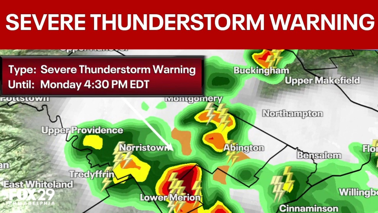
Philadelphia weather: Severe Thunderstorm Warning until 4:30 pm
FOX 29 meteorologists Scott Williams and Kathy Orr discuss the Severe Thunderstorm Warning that is in effect for the area until 4:30 pm.
Temperatures will stay in the 80s on Monday with some sunshine that will give way to scattered storms in the afternoon and evening.
The National Weather Service says isolated storms could be strong to severe, with damaging wind gusts and bouts of heavy rain.
Philadelphia and areas along the I-95 corridor have the best chace to see brief storms on Monday.
Severe Thunderstorm Warning
The National Weather Service has issued a Severe Thunderstorm Warning in the area Monday until 4:30 p.m.
The areas impacted include: Philadelphia, East Norriton, Conshohocken, Ambler, Jenkintown, Narberth, Rockledge, Morris Park, Plymouth Meeting, Germantown, Bryn Mawr, Chestnut Hill, West Conshohocken, Penn Wynne, Fort Washington, Blue Bell, Glenside, Flourtown, Spring House, and Ardmore.
This includes Pennsylvania Turnpike between mile markers 332 and 340, Northeast Extension between mile markers 21 and 23, Interstate 76 in Pennsylvania between mile markers 330 and 339 and Interstate 476 in Pennsylvania between mile markers 15 and 19.
Meteorologists are tracking wind gusts of up to 60 mph. For your protection, residents are urged to move to an interior room on the lowest floor of a building.
Flash Flood Warning
The NWS issued a Flash Flood Warning in Delaware, Montgomery, and Philadelphia counties until 8:00 p.m.
Areas that may experience flash flooding include: Philadelphia, Camden, Yeadon, Conshohocken, Hatboro, Ambler, Jenkintown, Narberth, East Lansdowne, Rockledge, Abington and Bryn Athyn.
Flooding of small creeks and streams, urban areas, highways, streets, and underpasses as well as other drainage and low-lying areas.
The NWS reminds folks to ‘Turn around, don't drown when encountering flooded roads…do not drive on flooded roads.'
What you can do:
For additional updates and weather information, visit http://www.weather.gov/phi
For further information on emergency preparedness, visit http://www.phila.gov/ready
What's next:
The threat of severe weather will become more widespread on Tuesday afternoon, when forecasters expect a band of strong storms to sweep across the Philadelphia area.
The latest models show the storm moving across the Philadelphia area during the late morning through the afternoon, starting in places west of the city around 11 a.m., hitting the city around 2 p.m., and moving towards the shore thereafter.
The National Weather Service has issued a flash flood watch for most of the Philadelphia area starting Tuesday morning through Wednesday afternoon.
The storm is expected to stretch from the Poconos down through Trenton and Philadelphia and the northern parts of Delaware. Forecasters expect Philadelphia and interior parts of South Jersey to receive the brunt of the storm,
Showers will become more scattered on Wednesday and continue to dissipate on Thursday. High temperatures on both days are expected to be in the low 80s.