

Philadelphia weather: Severe Thunderstorm Watch issued for region

PHILADELPHIA - Forecasters say sizzling heat on Wednesday could help spawn pop-up thunderstorms that could turn severe.
The National Weather Service issued a Severe Thunderstorm Watch that covers the entire region, including Philadelphia and its immediate suburbs.
The watch includes the threat of quarter-sized hail, wind gusts up to 70 MPH and frequent lightning strikes.

Watching severe weather | FOX Weather Philly
FOX 29 Weather Authority is monitoring severe weather for Wednesday afternoon, along with the rapid uptick in the heat.
What we know:
Temperatures on Wednesday soared into the 80s with increased humidity to create favorable conditions for the possibility of some late-day storms.
The National Weather Service issued a Severe Thunderstorm Watch on Wednesday afternoon that covers parts of Pennsylvania and New Jersey and all of Delaware.
Along with bouts of heavy rain, forecasters say quarter-sized hail, frequent lightning strikes and wind gusts of up to 70 MPH are possible from the scattered storms.
Any severe weather is expected to happen during the afternoon or early evening, according to forecasters.
What's next:
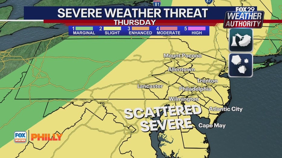
The risk of severe weather will also likely be present on Thursday, as forecasters expect conditions to be even hotter and more humid. A cold front is approaching from the west which typically adds an additional amount of energy to the atmosphere. Thursday's threat includes torrential downpours, isolated tornadoes, damaging wind gusts and hail.
The threat of rain and storms will pass just in time for Friday, which will kick off what's expected to be a stellar weekend in Philadelphia.
A sunny and warm Friday will set the tone for the weekend, and temps will continue to climb into the 90s on both Saturday and Sunday.
What you can do:
Stay up-to-date on the latest weather updates by downloading the free FOX LOCAL app.