

Weather Authority: A cloudy night ahead of potential severe weather as remnants of Nicole roll in
PHILADELPHIA - Thursday has been beautiful, much like the calm before the storm.
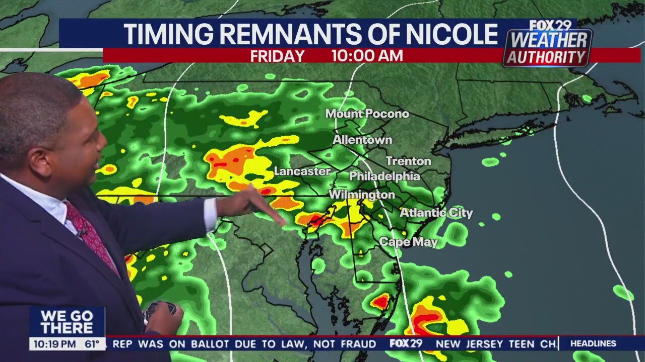
Friday will prove to be a different weather day. There are likely to be two rounds of difficult weather as the remnants of Tropical Storm Nicole churn north out of Florida.
Friday 10 a.m. through 6 p.m., the region will likely see scattered downpours and gusty winds.
Localized flooding and damaging winds are also possible for the area, forecasters say.
A lull in the energy is likely after 6 p.m. through midnight, when the second burst of energy will roll across the area, bringing more rain and stronger winds. Wind gusts are likely to be in the 25 to 40 mph range.
An isolated tornado can not be ruled out. Everyone should take note the possibility is there and remain alert into Saturday morning.
The heaviest rain is likely to fall north and west of Philadelphia, effecting the Poconos and the Lehigh Valley, as well as western Pennsylvania. With the exception of Jersey shore points, the Delaware Valley is likely to pick up one to two inches of rain, by the time it’s over.
The system should push out of the region early Saturday morning. The day will then be partly cloudy and breezy, with highs in the upper 60s.
The next few days look to be dry, but temperatures drop closer to average for this time of year. Monday and Tuesday could see highs not getting out of the 40s with overnight lows dropping into the 30s.
>> Stay up-to-date with changing weather conditions by downloading the FOX 29 Weather Authority app.
____
SEVEN-DAY FORECAST
THURSDAY NIGHT: Cloudy. Low: 54
FRIDAY: Rain, wind. High: 71, Low: 65
SATURDAY: Drier, breezy. High: 68, Low: 43
SUNDAY: Much colder. High: 51, Low: 36
MONDAY: Cold for the Birds. High: 48, Low: 32
TUESDAY: Cloudy, chilly. High: 48, Low: 40
WEDNESDAY: Shower chance. High: 50, Low: 36