

Weather Authority: Winter storm departs leaving behind an icy mess

Weather Authority: Winter storm departs leaving behind an icy mess
FOX 29's Sue Serio has more on the dwindling winter storm.
PHILADELPHIA - A winter storm that brought significant snow to parts of the region on Thursday before turning to spotty ice and sleet overnight continues to pull offshore Friday morning.
The National Weather Service has downgraded its Winter Storm Warning to a region-wide Winter Weather Advisory as the storm subsides. The advisory cites the change of freezing rain, light snow, and otherwise icy conditions through 7 p.m.
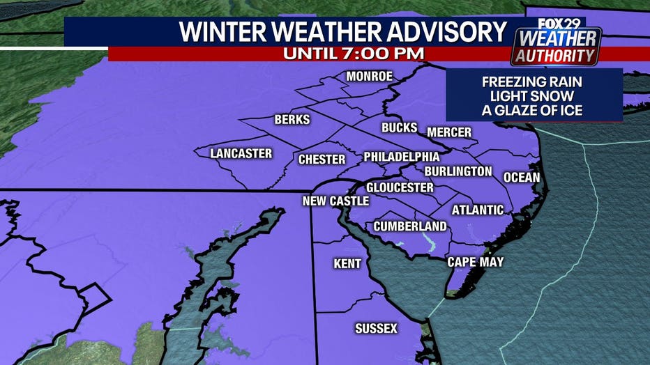
The last rush of winter weather will drag across parts of the region Friday morning with light snow to the north of Philadelphia and a wintry mix in southern New Jersey and Delaware. Meanwhile, Philadelphia and areas immediately surrounding the city could see intermittent frozen precipitation.
Temperatures will remain in the 20s in Philadelphia and surrounding areas, while coastal New Jersey and Delaware will be slightly above the freezing point. Most of the region will pull into the low 30s on Friday after the storm passes.
The region will have two days of much-needed sunshine over the weekend, but temperatures will remain bitterly cold on both Saturday and Sunday. Some more precipitation will move into the region on Monday, but temperatures will rise into the 40s. The warming trend will continue through the week with 50-degree temperatures slated for Wednesday and Thursday.
___
FRIDAY: Winter storm subsides. High: 34
SATURDAY: Sunshine returns. High: 32, Low: 25
SUNDAY: More sun. High: 36, Low: 19
MONDAY: Rain likely. High: 42, Low: 26
___