

Summerlike warmth to usher in the start of fall next week in Philadelphia
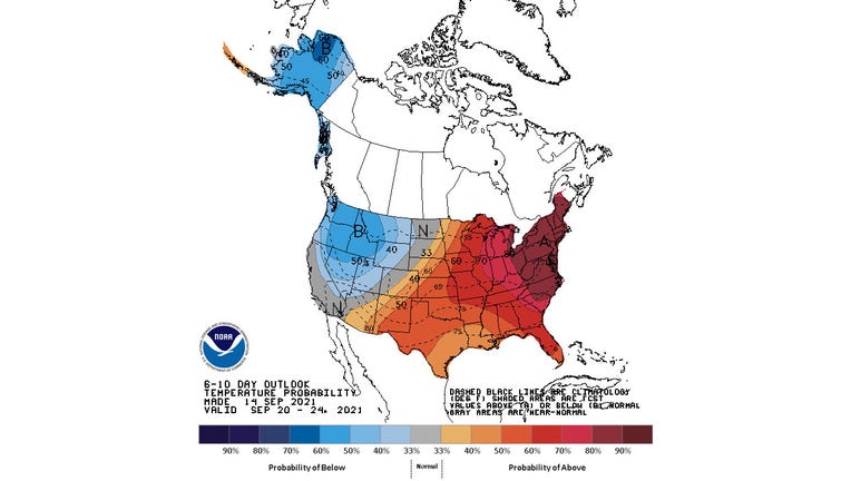
The 6- to 10-day temperature outlook valid Sept. 20-24, 2021. (NOAA's Climate Prediction Center)
PHILADELPHIA - The autumnal equinox might usher in the start of fall next Wednesday, but the weather has other plans for the eastern United States, including Philadelphia and the Delaware Valley.
Summerlike warmth will likely stick around into late September, according to a long-range forecast from NOAA's Climate Prediction Center.
The CPC's 6- to 10-day temperature outlook issued Tuesday highlights the entire Northeast and mid-Atlantic for an 80% chance of above-average temperatures during the period from Sept. 20 to 24, or next Monday through Friday.
In fact, the entire eastern half of the nation into much of the South has 50-50 or better odds of warmer-than-average temperatures next week.
Highs next week in Philadelphia are predicted to reach the 80s through at least Wednesday, the official first day of fall. Even the Shore and Poconos will be well into the 70s. Philly's average high temperature for the third full week of September is only in the upper 70s.
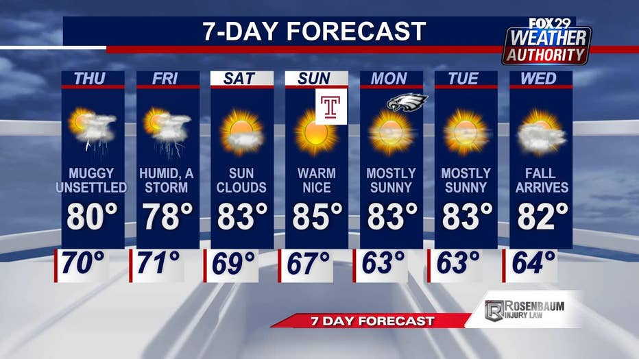
The 7-day forecast for Philadelphia valid Sept. 16 to 22. (FOX 29 Weather Authority)
This general pattern of above-average warmth in the East also shows signs of lingering into the final week of September.
The CPC's 8- to 14-day outlook for Sept. 22 to 28 shows a 60% chance of warmer-than-average temperatures from New England southward to North Florida.
If you're anxious for the cooler temperatures more typical of fall, you'll likely have to wait a few more weeks in our part of the nation.
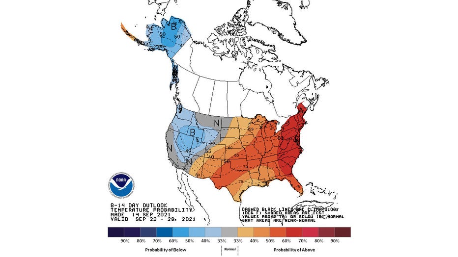
The 8- to 14-day temperature outlook valid Sept. 22-28, 2021. (NOAA's Climate Prediction Center)
___
DOWNLOAD: FOX 29 NEWS APP | FOX 29 WEATHER AUTHORITY APP
SUBSCRIBE: Good Day Digest Newsletter | FOX 29 Philly on YouTube